
© Gabriele Obino

DESCRIPTION
- Difficulty: E = Easy/Medium
- Walking times (excluding stops): Easy: about 1.5 hours Medium: about 3.5 hours
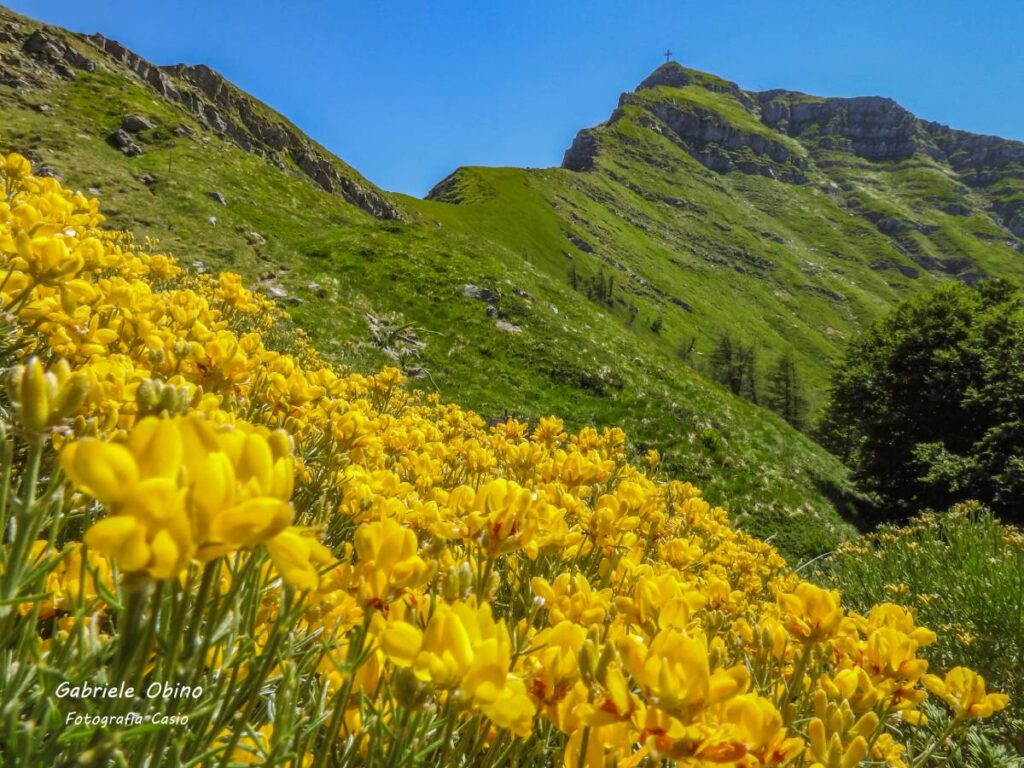
- Points of interest: Sanctuary, Waterfalls, Cavone Pond
- Flora: Maple, Beech, Ellebore
- Fauna: Frog, Spotted salamander, Roe deer
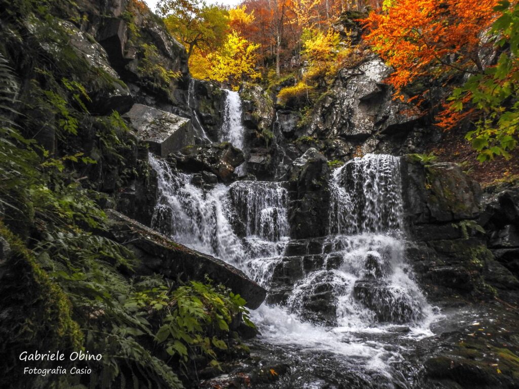
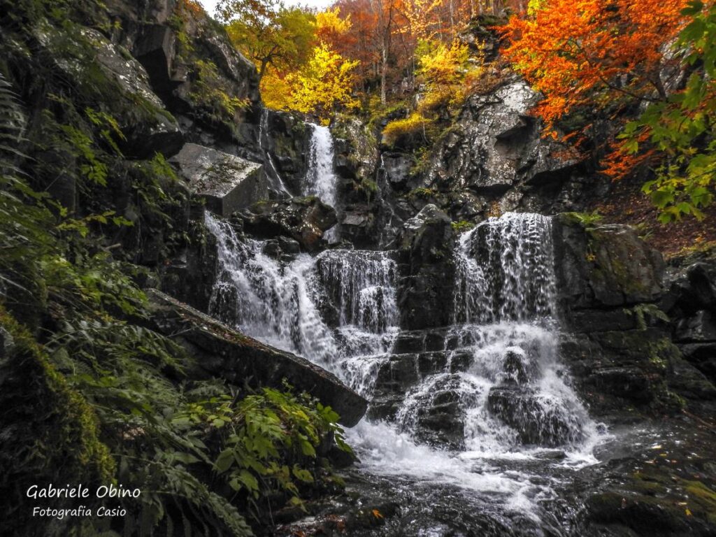
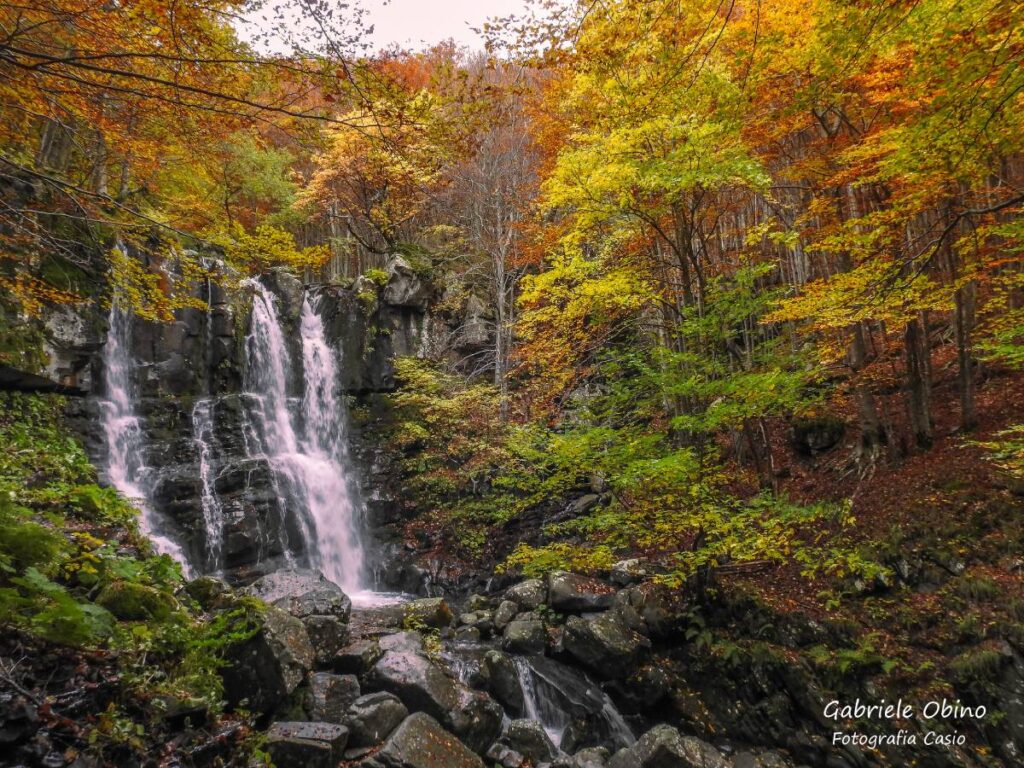
The trail leading to the Dardagna Falls (“seven waterfall trail”) can be divided into two “sections.” The first (sanctuary of Madonna dell’Acero – last waterfall) is easy and suitable for everyone, the second (last waterfall – Cavone) is of medium difficulty.
To start the trek you need to arrive by car or public transportation to Madonna dell’Acero, where you can visit the sanctuary and admire the centuries-old maple tree where legend has it that the Madonna appeared.
From here, exactly behind the building, the CAI 331 trail starts, a comfortable and wide path that will take you to admire the power of the waterfall. This first part is suitable for everyone, including children and the elderly, and presents no special difficulties or major elevation changes. In the cool waters of the Dardagna stream live animals such as the temporaria frog and the spotted salamander; the latter represents a biological indicator: it lives only in the cleanest water.
At this point you can decide whether to turn back along the same path or continue uphill toward the Corno alle Scale. To continue the trail up the course of the Dardagna Falls, you must take CAI Path 333, which climbs through the beech forest, skirting the watercourse. The trail has steep spots, although softened by stairs and handrails.
The spectacle offered by the waterfalls is truly unique: the Dardagna makes seven overhangs, and the trail skirts them all. To get as far as Cavone at the junction after the last waterfall (definitely smaller than the first ones encountered) you will have to turn abruptly left onto CAI path 337.
This last section will take you near the Cavone pond. From here you will have to go down the paved provincial road to Madonna dell’Acero.
USEFUL TIPS
As with all trails in the Alto Reno Terme area, it is advisable to bring hiking boots or hiking boots, long pants, jacket for wind and rain, water bottle full of water and provisions. Also bring along a trail map, compass, GPS or smartphone with pre-loaded trail tracks, which can be downloaded from www.caiporretta.it.
For your safety use the GeoResQ app : the service is operated by the Corpo Nazionale Soccorso Alpino e Speleologico (CNSAS) and promoted by the Club Alpino Italiano (CAI).
